PONTEFRACT ROAD
MONKROYD COTTAGE TO THE TRAVELLERS' HOTEL

Probably nobody knows how old Monkroyd Cottage is, but it is shown as Swine Lane Cottage on the 1849 Ordnance Survey map. It is the last house on the road to Pontefract. Photo - Dr J Gatecliff Collection.

Photo - Dr J Gatecliff 1983.

Photo - Google Street View 2023.
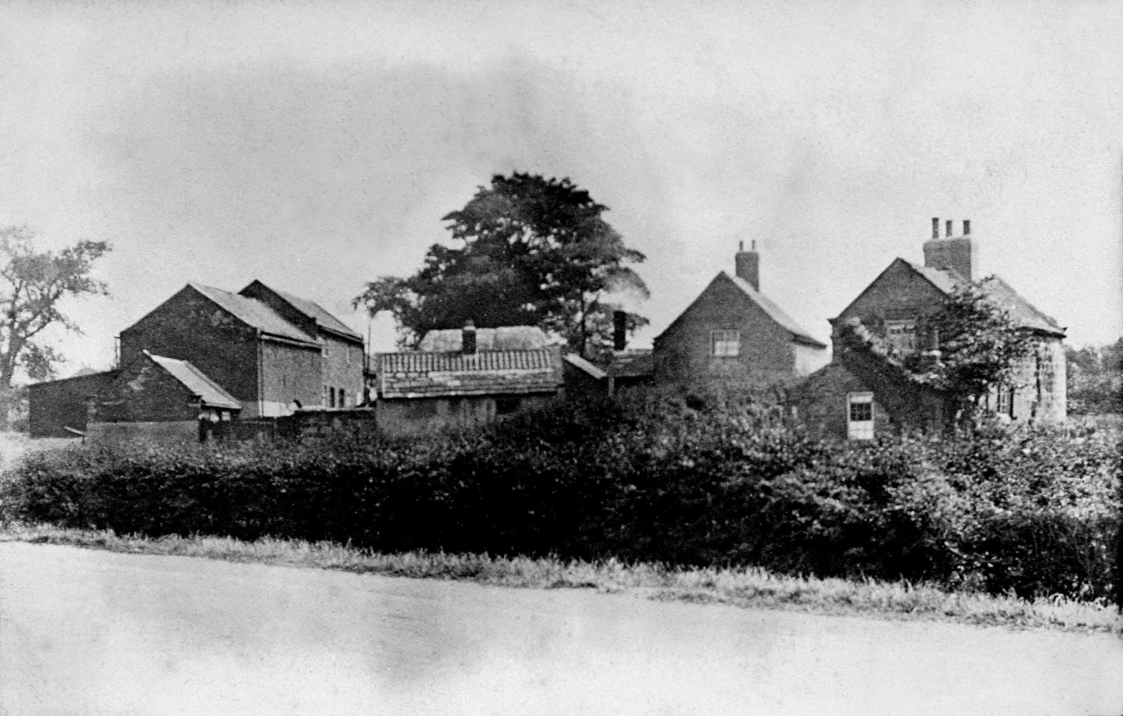
Across the road from Swine Lane Cottage was Ravensknowle Farm. Photo - Dr J Gatecliff Collection.

It is now known as Farmer Copley's Google Street View 2023.

In modern times it has been adapted to being a visitor centre as well as a farm. Photo - personal 2019.

South Featherstone Senior Council School was opened in 1930. The locals shortened that to "The New School". Photo - Google Street View 2009.

The school was hidden behind a line of trees planted many years before on the boundary of Leatham Park Estate. In 1931 the West Riding County Council wanted to widen the main road so the trees had to go. Photo - the Dr J Gatecliff Collection.

The trees were removed and the road widened, a footpath added and a boundary wall built. The county council refused to replace the trees so Leeds University donated 14. Photo - the Dr Gatecliff Collection.

The same view in 1976. Photo - Dr J Gatecliff.

The school leaving age went up to 16 in 1972. The result was the senior schools had too many pupils. Prefabricated Stephenson classrooms were installed. They can be seen at South Featherstone Secondary School in the background of this 1974 photo by Steve Nash.
New schools were built and this one remained empty for many years until it was demolished in 2022. Photo - Dean Morgan.

New schools were built and this one remained empty for many years until it was demolished in 2022. Photo - Dean Morgan (Featherstone Bygone Days).

Houses were built on the site. Photo - personal 2024.


The name was changed to Featherstone Technology College in 2005 and again to Featherstone Academy in 2012. Photo - Wikipedia.

Leatham Lodge was built about 1820 by Charles Leatham. a banker. as the gateway to a mansion which he planned but didn't build. The lodge is on the 1949 Ordnance Survey map. Photo - Dr J Gatecliff Collection.

By 1967 it was in a run down condition and in danger of demolition. It was saved by Mr R C Hornby. a decorator. who rented it from the then owner. Mr T Hemmingway. and renovated it. Photo - Dr J Gatecliff.

Planning permission was given for an extension providing it was in the style of the original building. Photo - Sid (Flickr).

The main road through Purston went round in an arc from Little Lane to the Lodge, probably because of the Leatham Estate boundary. The end of the arc can be seen on this postcard.

This postcard shows the start of the arc at the other end. Little Lane is on the right.

This view from Google Street View shows the old road on the right, the 1931 road in the middle, and some of the first council houses built after the 1939-45 war on the left.

The built up crescent from the west end. Photo - personal 2020.

The row of houses on the left were Purston Terrace (Sometimes called Fox Row). It was demolished after the 1939-45 War as part of the slum clearance programme.

A block of flats for elderly people with a resident warden was built on the site of Purston Terrace and opened in 1965. Photo - Dr J Gatecliff 1988.

The flat roof caused problems and had to be replaced. Photo - Dr J Gatecliff 1998.

The building became no longer fit for purpose, and after standing empty for years it was demolished in 2924. Photo - personal.

The White House, the large detached house on the left, was built (probably in the 1880s) for Mr Maxwell who had businesses in Station Lane. It was bought by Charles Raybould, a Featherstone bookmaker, and turned into a private members club in 1963. Photo - a postcard. The photo below of the same view in 1981 is by Dr J Gatecliff.


The White House pub in 2020. Photo - personal.

The Travellers Rest inn sign claims it is a 17th century inn which may be true, but there is no way of proving it. The earliest documentary evidence is a map dated 1805. The building obviously dates from the 1800s. Photo below - a postcard.
_NEW.jpg)

Photo - Ian S (Geograph) 2014.

Photo - personal 2020.
_NEW.jpg)
The building in which Purston Post Office was situated is dated 1898. The shop was an ice cream/sandwich shop, and the small premises in between was a barbers. Photo - Tony Lumb Collection.

Photo - Dr J Gatecliff 1993.

It was all change in the 21st Century. The post office and barbers closed, a new hairdressers opened in two-thirds of the ex-post office premises, and the Munchbox moved into the enlarged site which was the old barbers and part of the post office. The original Munchbox was converted into a house. Photo - personal 2020.
THE TRAVELLERS' HOTEL TO THE JUNCTION HOTEL

This postcard shows the main road from the Hall Street junction to the Junction Hotel. It really was part of Wakefield Road probably until the 1960s. The reason may have been because it used to be a toll road and there was a toll booth at the junction with Hall Street.

The shop on the left is a newsagents. At one time it was owned by Irving Malpass who also sold petrol. Photo - Dr J Gatecliff 1967.

An old postcard showing the view from Hall Street to the Junction Hotel.
_NEW.jpg)
The same view in 2020. Photo - personal.

Another postcard showing the view the other way. The blacksmith's workshop is on the left.

The same view in 2020. The blacksmith's workshop has long since become redundant and was demolished.

The William Hill firm took over the blacksmith's site and erected a wooden betting shop. The white house was originally a wartime shelter and was converted after the war. The roofline of the shelter can still be seen. Photo - Tony Lumb Collection.

Back up the road was the Jones' convenience store. When it closed down William Smith took over and the wooden betting shop was demolished. Photo - Dr J Gatecliff.

William Hill closed this betting shop the same year that the photo was taken. Photo - personal 2020.
_NEW.jpg)
At the junction of Hall Street and Pontefract Road was the toll road house and the Pontefract Co-operative store. No photograph has turned up for either. The toll house was demolished in the post-war clearances and the store was changed to a car saleroom. Photo - Betty Longbottom (Geograph 2010).

A change of ownership took place. Photo - personal 2020.
_NEW.jpg)
John Waller bought the big house at the junction of Pontefract Road and Ackworth road in 1828 and turned it into a pub. He added a large extension in 1892 and built his own brewery (the tall building).Photo - a postcard.
_NEW.jpg)
Tarmac for road surfacing was patented in 1902. It eventually made a remarkable difference to the local roads. Photo - a postcard.


This large extension was built onto the original pub in 1892. Photo - Dr J Gatecliff 1987.

It was closed in 2020 during the Covid pandemic and put up for sale. Although sold, it remained closed in 2024. Photo - Christie & Co. sale brochure 2021.
THE JUNCTION HOTEL TO STATION LANE

Purston National School, so called because it was built under the auspices of the National Society for Religious Education, was largely funded by a grant from Revd Thomas Hall of Purston Hall. It opened in 1861 and a basic education cost 3d per week per child. Photo - a postcard.
It was extended over the years, and in 1951 was declared to be unsafe and was closed. After repairs it reopened for the juniors, but the infants remained at South Featherstone School further up Pontefract Road.

The footpath past Purston School was considered too narrow for safety and for years there was a plan to widen it. In 1979 the money was allocated and it was done. The school lost much of its playground, and the conker tree at the entrance had to go.

New schools were built in Nunns Lane and George Street and this one was demolished in 1981. Photo - Featherstone Bygone Days.

Brookway was built at the end of 1923. Before then the Went Beck, which ran across the site, had to be diverted to near Pontefract Road, and Brook Farm had to be demolished. Pringle's garage and car showroom is on the left. Photo - Dr J Gatecliff 1966. Mr Chesney, the council surveyor, drew up the scheme for the beck diversion and he included a paddling pool in it. It became known as Chesney Bay. This was taken before the old buildings of Brook Farm were demolished. The new St Thomas Road houses are in the background. Photo - Featherstone Library Collection. In 1948 the council decided the water was not suitable for bathing (paddling) and notices were put up prohibiting it. |

Chesney Bay was immediately behind where the Pontefract Road bus stop is situated. The houses in the background are Brookway. Photo - personal.

Pringles garage with the petrol pumps on the right and the car showroom on the left. Photo - unknown.

The car showroom was changed to a snooker hall in 1987. Photo - personal.

Google Street view 2009.

The snooker hall closed down and was replaced by a fireplace showroom. Photo - Google Street View 2023.


The disused gas works and buildings at the Junction of Girnhill Lane and Pontefract Road were demolished and cleared for the erection of the Lidl supermarket. Photo - Google Street View 2011.

The same view in 2023.

There were regular accidents at the Station Lane crossroads. The first attempt to reduce them was to install road markings and bollards. Featherstone Council wanted traffic lights but the West Riding County Council and the police didn't. Photo - a Frith postcard.


The traffic lights were installed in 1966. Photo - Dr Gatecliff 1981.