FEATHERSTONE LANE
In the years before the railway came to Featherstone in 1848, and there were very few houses between Purston and what is now North Featherstone, the whole of the road from Wakefield Road to (Old) Featherstone was called Featherstone Lane. Then the length with the station was called Station Lane, the next section became an extension of Green Lane, and the last part was renamed North Featherstone Lane. Two organisations to use that name were North Featherstone Lane School, and North Featherstone Lane Working Men's Club. The new "North" tag never caught on and it fell out of use.
NORTH FEATHERSTONE CROSSROADS TO SEWERBRIDGE BECK
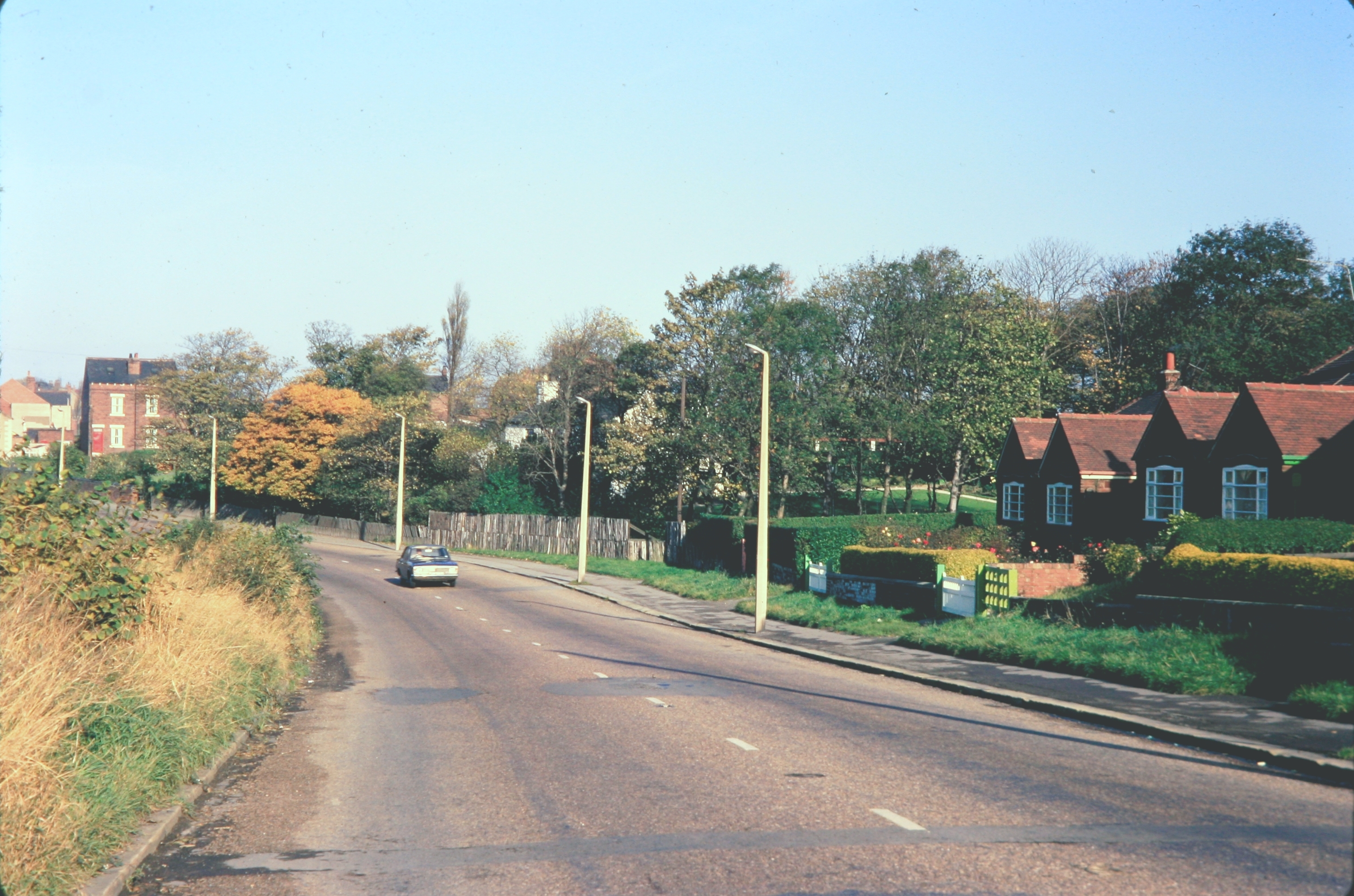
The north end of Featherstone Lane. Photo - Featherstone Library Collection.
 |
The same scene in 2019. Photo - personal
|
|
|
|
|
|
|
|
|
Further down the lane in 1971. Photo - Dr J Gatecliff.
 |
An old postcard of the hill to North Featherstone.
|
 |
The same view in 1971. Photo - Dr J Gatecliff.
|
 |
Another postcard, taken from further back.
|
 |
Another same view taken in 1971 by Dr Gatecliff.
|
 |
The Green in 1981. Photo - Dr J Gatecliff.
|
 |
Brooksbank's Garage opposite The Green in 1983. Photo Dr J Gatecliff.
|
Brooksbank's Garage in 2014. Photo - Ian S (Geograph). All Saints' Church vicarage was built in 1891 and is now a care home. Photo - Ian S (Geograph) 2014.
 |
Vicarage Gardens, the estate built in the field in front of the vicarage. Photo - Dr J Gatecliff.
A photo taken from the other end by Betty Longbottom (Geograph) in 2009.
|
The Sewerbridge Beck, the southern boundary of North Featherstone, flooded in 1983. Photo - Dr J Gatecliff.
SEWERBRIDGE BECK TO CRESSEY'S CORNER
The flooded beck in 1983. Photo - Dr J Gatecliff.
 |
Another view of the flooded beck in 1983. photo - Dr J Gatecliff.
|
A panoramic postcard view.
The bend on a sunny day in 1969. Photo - Dr J Gatecliff.
For many years there were few houses at the west side and no footpath as this postcard and the following one show.
The United Free Methodist Chapel, built in 1902, can just be seen beyond the houses on the left.
 |
The new North Featherstone Lane Working Men's Club built across the road
from the old premises opened in 1962, and closed down in 2004. The chapel closed in 1955 and was now an industrial site. Photo - Dr J Gatecliff 1996.
The area was cleared and housing built in 2009. Photo Google Street View.
The next three postcards show the change from gas lighting in the street, discontinued in 1924, and no telephones, to electric lighting and multiple telephone lines.
|

This postcard is unusual in that it was taken looking towards Cressey's Corner unlike all the others.
The next three were taken by Dr J Gatecliff.
1967
1975
 |
1985
Grace Dieu Villa the home of the Alexander family of teachers, is difficult to spot on the three photos above this one. The plaque on the wall has the year 1894 on it. photo - Google Street View. |
In 1945 the Featherstone Clothing Company took over the wooden building that used to be the adult school. In the 1960s it became part of the Gaunson group and a new factory was built on the site. In 1991 it closed because of lack of orders and the inability to compete with cheap imports from Eastern European countries. Photo - Wakefield Libraries.
Mount Pleasant house was the home of John Walmsley. a builder, who erected many of the first houses in what became to be called South Featherstone. It is after the beginning of North Featherstone Lane. It was one of the first two dwelling to be built between Green Lane and the Sewerbridge Beck. Photo - Dr J Gatecliff.
John Walmsley was a devout Primitive Methodist. In 1901 he converted his workshop next to his house into a Primitive Methodist Chapel. It later became a chapel for the Featherstone Welsh community, and finally a shop. Photo - Ian S (Geograph).
In 1903 a much larger Primitive Methodist Church was built nearby and in 1913 a Sunday School was built on the back. Photo - a postcard.
In 1968 when the Methodist Churches joined together in a new church in Wilson Street this one was closed. It was used for a while as a clothing factory but was eventually demolished and houses built. Photo - Google Street View.
The Start of Featherstone Lane where the road from Green Lane turns left. Mount Pleasant house is on the left. photo - a postcard.
 |
Cressey's Corner in 1983. Named after a North Featherstone farmer who had a butcher's shop on the right of the photo by Dr J Gatecliff.
|
 The north end of Featherstone Lane. Photo - Featherstone Library Collection.
 Further down the lane in 1971. Photo - Dr J Gatecliff.
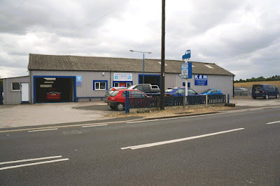 Brooksbank's Garage in 2014. Photo - Ian S (Geograph).