ACKWORTH ROAD
PONTEFRACT ROAD TO HALL STREET

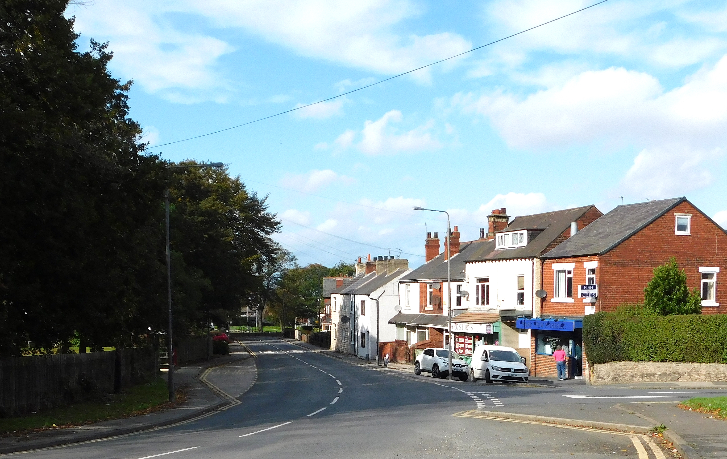
The north end of Ackworth Road where it meets Pontefract Road. The roads were often in this condition all over the area. Photo - from a postcard.

The patenting of tarmac in 1902 made a big difference to the road surface. Photo - from a postcard.


From the junction with Pontefract Road to the junction with Hall Street large houses were mixed in with cottages. This is Bedford House. Photo Dr J Gatecliff 1993.

Some of the cottages. Photo - Dr J Gatecliff 1975.


Now the Field House address is Katrina Grove, and it is surrounded on three sides by new build. Photo - Google Street View.

York House once included a butcher's shop, but all trace of it has now disappeared. Photo - me 2020.
.JPG)
Next to York House is a pair of pre-1890 semi-detached houses. Photo - Dr J Gatecliff 1970.

Now they are mostly obscured by trees. Photo - Google Street View 2011.


The cottages after some conversion work. Photo - Dr J Gatecliff 1983.
HALL STREET TO COACH ROAD

The north lodge for Purston Hall. The council decided in 1970 it would cost too much to keep in good order and it was demolished. Photo - Dr J Gatecliff.

Featherstone Council bought Purston Hall and Park in 1930 and erected this wall and gates at the entrance. Photo - A Frith postcard.


Glencoe Villa overlooks the park. The plaque on the wall has 1890 on it. Photo - Glencoe Villa Facebook.

Photo - personal 1987.
_NEW.jpg)
 |

An old postcard showing the road from the park entrance to the bend round the park.
.jpg)

The same stretch of road from the other end. Photo - a postcard.

A new entrance was made further up the road from the original to commemorate the Festival of Britain in 1951. It included a pergola and a motto over the entrance Pro Salute Publico "For the health of the people". Photo - Featherstone Council souvenir programme.

The pergola. Photo - Featherstone Council souvenir programme.

The second entrance now. The pergola and motto have gone. Photo - personal 2019.

There is a plaque in the wall at each side of the entrance. This is the original one from 1931 and is badly worn. It reads "This is the public park of Featherstone" Photo - Google Street View.

This is the one at the other side of the entrance. Photo - personal.


.jpg)
COACH ROAD TO ACKWORTH PIT

This track from Ackworth Road is called "Chapel Lane" on the 1849 Ordnance Survey map which suggests it lead to the chapel which was in Purston hundreds of years ago. It actually went all the way through to Ackworth Park Estate, and a lodge was built at the Purston end called Ackworth Park Lodge. Because it was used as a short cut for coaches from Ackworth Park it was, and still is, called "Coach Road" by the locals. Photo - personal 2019.

The lodge was originally called Ackworth Park Lodge. By the 1914 Ordnance Survey map it had changed to Purston Lodge. Photo - personal 2019.


The lodge has been renovated and altered. Photo - Google Street View 2023.

This old postcard shows the road round the park.

The same view in 2019. Photo - personal.

These travellers camped in the park in 2021. Photo - Paul Clarkson (Featherstone Bygone Days).

Wakefield MDC put up this sign. Photo - Google Street View 2009.

Featherstone Council decided this sign was more appropriate, although some people pointed out the War Horse isn't in Purston. Photo - personal 2019.

The South Lodge to Purston Hall was built in 1889 for Elizabeth Hall, a widow, who lived in the hall. Photo - personal 2019.

The lodge was put up for sale by Wakefield MDC. It was sold and the new owner set about renovating it. Photo - Google Street View 2023.

The finger sign post at the junction with Went Lane. Photo - Dr J Gatecliff 1967,
_NEW.jpg)
The replacement modern sign in 2019. Photo - personal.

The junction with Went Lane in 2019. This is another road with a local name. It was, and is, always called Wragby Road by some locals, although it never was officially that.

The South end of Ackworth Road. After Ackworth Pit it was Purston Lane. Photo - Dr J Gatecliff Collection.

Work began on sinking a shaft at the Purston/Ackworth boundary. Although it was in Purston it was decided to call it Ackworth Pit. It was to provide better ventilation for Ackton Hall Colliery and reduce the underground travelling time for some of the miners. Photo - personal 1987.

Eventually most Ackton Hall miners went down at Ackworth Pit, baths and a canteen were built, and workshops for the electricians and fitters. Photo - Pontefract and Castleford Express.

Ackworth Pit closed in 1985 after the year long miners; strike along with Ackton Hall Colliery. Photo - Sparky.

The site was cleared and a housing estate built. Photo - Google Street View 2023.