NORTH FEATHERSTONE
ALL SAINTS' CHURCH
There was a church in North Featherstone when the Domesday Book was written in 1086, but the present church is the result of an extensive rebuild from 1879 to 1882. The clock was installed at the end of 1900, and set going on 1 January 1901.
From the Tony Lumb Collection.
A postcard.
The choir stalls and alter before the 1998 fire (see below), Photo uploaded to Flickr by Sid.
Photo by Dr J Gatecliff 1964.
Photo by Bill Henderson (Geograph) 2002.
Photo by J Thomas (Geograph) 2011.
Photo by Anthony Parkes (Geograph) 2013.
Photo - All Saints' Church Website.
This is the remains of a cross and is a listed monument. Photo - Historic England.
In the 1920's the stonework on the tower was in poor condition, but there was no money to re-build it. It was decided to put a stone casing round it, and an appeal was made for funds. The tower was cased as the money came in between 1929 and 1932. The following two photos show the before and after.
Photo uploaded to Featherstone Bygone Days by Jackie Los Birkinshaw.
.jpg) Photo by Steve Norfolk 2020.
Photo by Steve Norfolk 2020.
The join between the original stone and the casing can be seen on the left of this widow opening.
There was a fire in 1998 which destroyed the organ and the vestries. It was decided to change the church into a community church with two rooms provided for community use. The work was completed in 2000. The following photos are from the church's website.
The alter.
The font.
The community section.
THE CEMETERY
All Saints' churchyard filled up rapidly because of the increase in population so Featherstone Burial Board was formed in 1872. The cemetery opened in 1874. Two chapels were built, one for Church of England funerals, and one for Nonconformists.
A postcard.
 |
| Photo -Dr J Gatecliff 1983. |
 |
A personal photo of the chapels in 2019.
The entrance. Photo - Ryan Kitchen 2016.
The main pathway 2019. Photo - personal.
The far end of the cemetery. Photo - Ryan Kitchen 2016. |
 Ryan Kitchen 2016.Some new graves. Photo - Ryan Kitchen 2016.
_NEW.jpg)
Photo - Betty Longbottom 2009.
THE SHOT MINERS' GRAVES
In a confrontation at Ackton Hall Colliery in 1893 soldiers fired on a crowd injuring many, and two died from their wounds. They were buried in side by side graves. After nearly 100 years as the centenary approached Wakefield MDC, who were responsible for the cemetery since 1974, decided to have the grave stones renovated and reset.
Photo by Frank Waude 1985.
Photo - Camperman64 (Flickr)
In 2018 Featherstone Town Council decided the graves needed some more TLC. The photo (personal) below was taken in 2019 after their work was completed.
THE LORD NELSON INN
The Lord Nelson Inn is mentioned in Edward Baines' 1822 Directory. The licence was given up in 1867 and the property changed to residential use. There were mounting steps outside to aid customers to get on their horse. These remained for many years but were eventually removed because they were considered a danger to traffic. They are now left in the side entrance as a reminder.
A postcard.
Photo - the Dr J Gatecliff Collection.
The following three photos are personal, taken in 2019
 |
| The mounting steps in storage. |
 |
| Nelson Cottage. | | |
THE BRADLEY ARMS
The Bradley Arms was originally the Sun Inn and it is named as such in an 1822 directory. The name was changed to the Bradley Arms when George Bradley bought the Ackton and Featherstone estates in 1865. The first two photos are taken from postcards.
Photo - useyourlocal website.
A personal photo 2020
THE SUN INN
Shortly after the Nelson Inn closed and the Sun Inn changed its name to the Bradley Arms a new public house was opened near to the old Nelson Inn and it took over the name of the Sun Inn. At first it was only a beerhouse, but it got a full licence in 1875. It was demolished in 2011 to make way for housing.
Photo - Featherstone Library Collection
 |
| Uploaded to Featherstone Bygone Days by Susan Rayner, |
The Sun Inn demolished. Photo - Google Sreet View 2011.
Houses built on the site. Google Street View 2019.
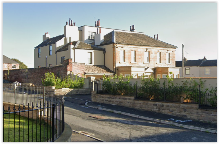
FEATHERSTONE HALL
Featherstone Hall may have its origins in 1780 when the house shown below was built onto the farmhouse at the left. Work began in 2019 to convert the house into three apartments, and build houses in the grounds behind.
Uploaded to Featherstone Bygone Days by Ian Clayton.
Uploaded to Featherstone Bygone Days by John Cameron.
 |
| Spawforths Architects 2019. |
 |
| Photo - Fairfield Homes 2019. |
 |
Photo - Fairfield Homes 2019.
Google Street View 2022.
Photo - OnTheMarket 2023. |
THE NATIONAL SCHOOL
The National (Church) School was opened in 1820, and had to be extended as the population grew. The photo below, taken from a postcard, shows the original building in the centre with extenions all round.

|
The above photo was taken in 1974 by Dr J Gatecliff. The school closed the next year and was changed to a community centre. It was sold in 1999 and converted into a private dwelling. The personal photo below was taken in 2019 and shows all the extensions were removed. 
OLD FEATHERSTONE WORKING MENS' CLUB
The building shown below was described as "The Villa" on the 1890 Ordnance Survey map. The Council gave permission in 1903 for it to be changed to a working men's club. It was extended over the years but eventually ran into financial difficulties and was closed. It was demolished, and houses built on the plot.
The original villa. A detail from a postcard.
Photo - Wakefield Libraries Collection. Photo - Betty Longbottom (Geograph) 2009.
The site cleared. Photo uploaded to Featherstone Bygone Days by Keith Galey.
The site in 2022. Photo - Google Street View.
THE POST OFFICE
The original Post Office was behind the school. In 1901 it was moved to premises in newly built Housley Terrace. It is possible to make out where it was next to the end house of the terrace. Photo - a postcard.
The Post Office was moved again to its final position further up the road.
|
 |
Photo - Dr J Gatecliff early 1990's
|
 |
Photo - Personal 2019
THE MANOR HOUSE
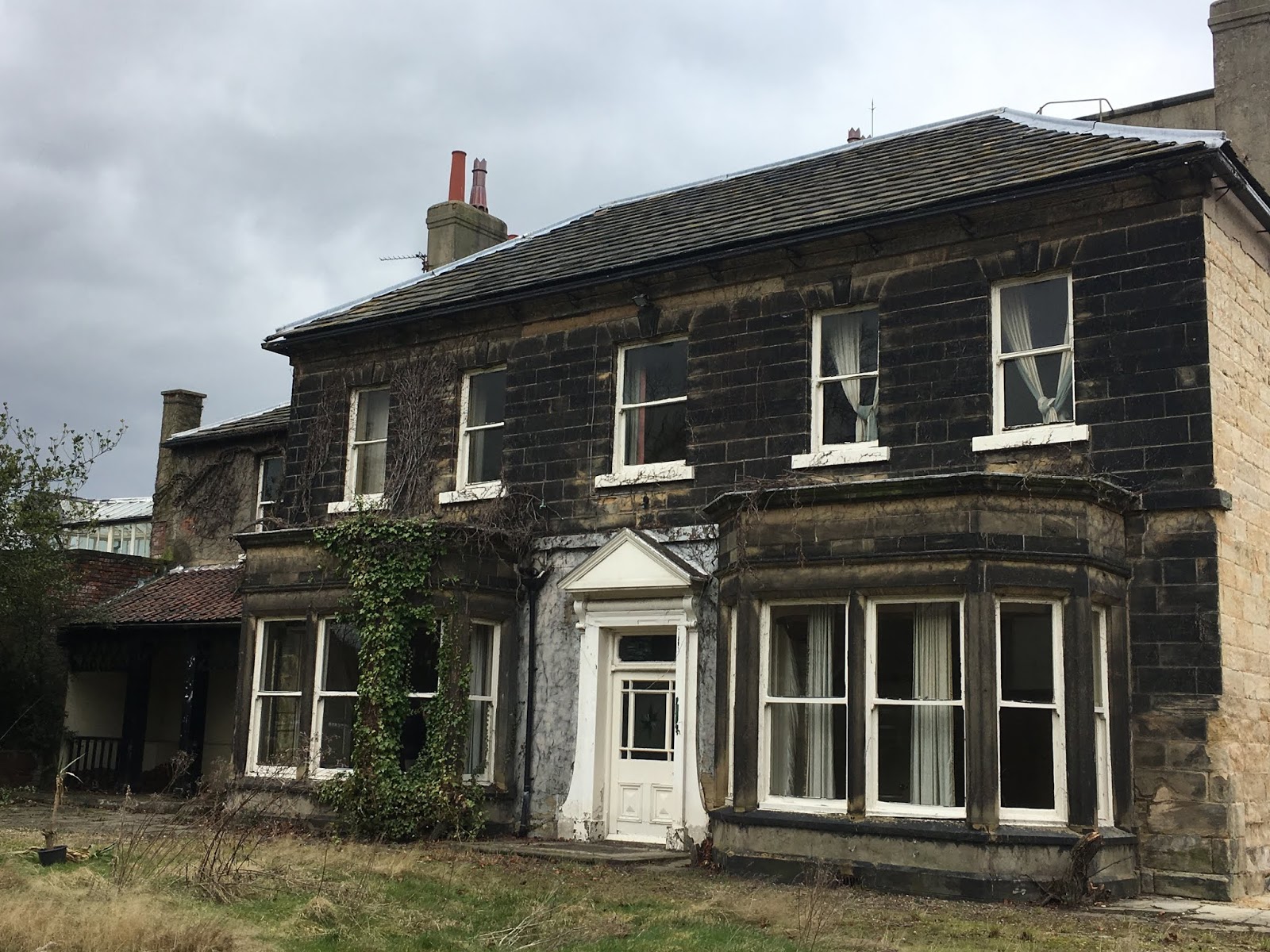
The year of the building of the Manor House is not known, but it is shown on the 1849 Ordnance Survey Map. It had many residents, one being John Shaw the owner of Featherstone Main Colliery. It suffered the same fate as Ackton Hall, being eventually divided into separate apartments. The Council decided in 1950 because of its condition and it had no archectural merit it would be demolished and the land used as part of a planned council house estate.
The Manor House in Church Lane. Photo - a postcard.
|
A close-up from a different postcard.
WILLOW LANE
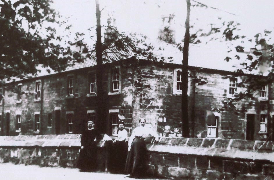
Willow Lane is the continuation of North Featherstone Lane after the crossroads. It was probably named that because there was a willow plantation nearby used to provide material for basket weaving. The old terrace called New Row can be seen at the far end of this postcard.
A personal photo 2019.
New Row was one of the oldest terraces in Featherstone but its age was unknown. It was demolished in 1936.
The Wesleyan Chapel below was opened in 1844. It was converted to ttwo semi-detatched houses in the 1940's after the Second World War.
A postcard showing the chapel.
 |
A 2019 personal photo showing the conversion.
ST. WILFRID'S CATHOLIC HIGH SCHOOL
St Wilfrid's Catholic High School opened in 1963. It has been extended a lot since then.
|
 |
| Photo - Dr J Gatecliff 1976 |
 |
Photo - Betty Longbottom (Geograph) 2009.
Photo - Ryan Kitchen 2016. |
 |
| Photo - personal 2019 |
WATER STORAGE
Water was first piped from Wakefield Corporation in 1890. There was a reservoir built between Snydale and Streethouse, but it had leakage problems and did not supply enough pressure for North Featherstone. A new storage tank was erected in 1902 in North Featherstone to boost the pressure for all of Featherstone and Purston.
The original water tank. A personal photo.
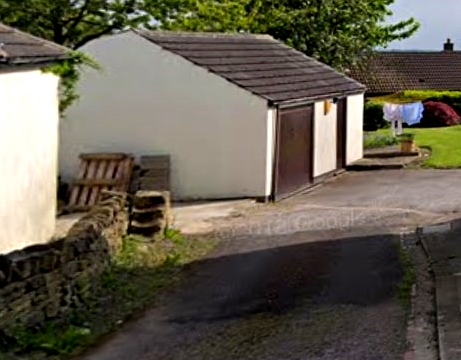
Eventually that couldn't cope so a concrete water tower was erected and opened in 1953. Bigger water mains eventually solved the problems and first the steel tank was dismantled in 1990 and then the concrete tower. Photo - personal.
Uploaded to Featherstone Bygone Days by Susan Rayner.
The removal of the steel tank. Photo - unknown.
THE CROSSROADS
North Featherstone crossroads were adequate for horse drawn vehicles, but were unsuitable for motorised transport, and there were many accidents. Traffic lights were installed in 1984, and a camera in 1990.
Photo - Featherstone Library Collection.
North Featherstone Lane Entry
Ackton Lane Entry
A postcard.
 |
A personal photo 2019.
|
Willow Lane Entry
 |
| photo - Dr J Gatecliff 1974. |
|
|
|
|
|
|
|
|
 |
Google Street View 2019.
|
Park Lane Entry Photo - Dr Gatecliff 1983.
A close-up from the above photo which shows the walls on the left of the junction, which caused problems for drivers wanting to turn in to North Featherstone Lane.
Photo - Dr Gatecliff 1984.
 |
Photo - personal 2019.
|


.jpg)


.jpg)


_NEW.jpg)


.jpg)


_NEW.jpg)

